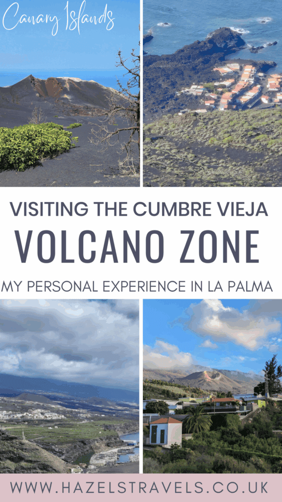
When La Palma’s Cumbre Vieja volcano erupted in 2021, I remember watching clips online – rivers of lava flowing through banana farms, homes vanishing beneath molten rock, and a whole coastline reshaped in real time. It looked surreal, like something out of a film.
Four years later, I finally set foot on the island to see it for myself. Nothing prepared me for how raw and recent it all still feels.
I may earn a small commission if you make a purchase using my affiliate links.
Into the Ashes: Visiting La Palma’s Eruption Zone 🌋
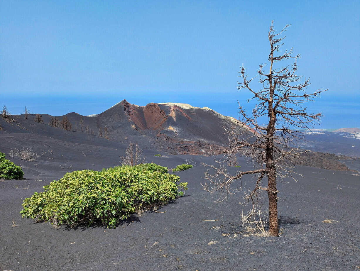
The western side of La Palma island wears its scars openly. Roads simply end, blocked by walls of black volcanic rock. Hillsides that were once green are now frozen waves of lava. Some valleys are eerily silent – just ash, twisted trees, and the faint sound of wind.
But here and there, new life is pushing through: green shoots, tiny flowers, a stubborn kind of hope.
I didn’t go with a guide, as I left it too late to book a tour. So it was just me, walking quietly through the edges of this transformed landscape. Locals I met were warm, open, and often eager to share stories – of evacuation, of resilience, and of how life goes on after lava.
If you visit La Palma, I really recommend seeing the eruption zone. But go gently.
- Some areas are still closed or rebuilding (always check ahead).
- A guided tour will give you safety, context, and stories you might otherwise miss.
- And if you’re photographing or walking near homes, be respectful. This isn’t just a landscape, it’s lived experience.
View from Volcán de San Antonio: Lava, Loss & a “Miracle House” 🖤
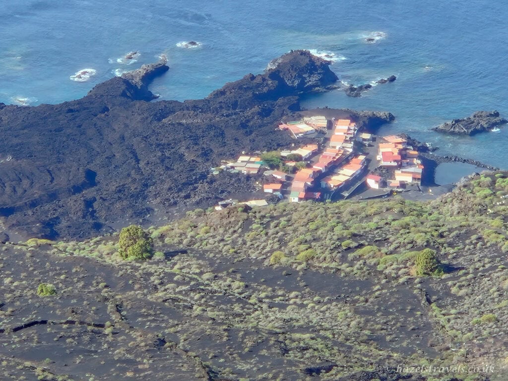
One of the most moving moments of my trip was standing on the rim of Volcán de San Antonio, looking down over Los Campitos and what was once the village of Todoque.
From up here, you can clearly see the lava’s path: sweeping through banana farms, covering homes, and forging a new black coastline. The contrast of green hills and dark ridges is breathtaking – and sobering.
The Miracle House 🏠
I’d heard about the so-called “Miracle House” before I arrived. It was a little white home that somehow survived while everything else around it was consumed. The owners, a Danish couple, watched on the news in disbelief. Locals called it magic. For a while, it stood as a tiny symbol of hope.
You might have seen it too – it featured in global headlines, including the BBC article that captured the world’s imagination.
But the volcano had other plans. A few days later, the lava shifted – and took the little house too.
Nearby, the village of Todoque was completely destroyed. One of the last buildings to fall was the village church, Iglesia de San Pío X. When the bell tower finally collapsed, it became a kind of turning point – a deeply emotional moment for the island.
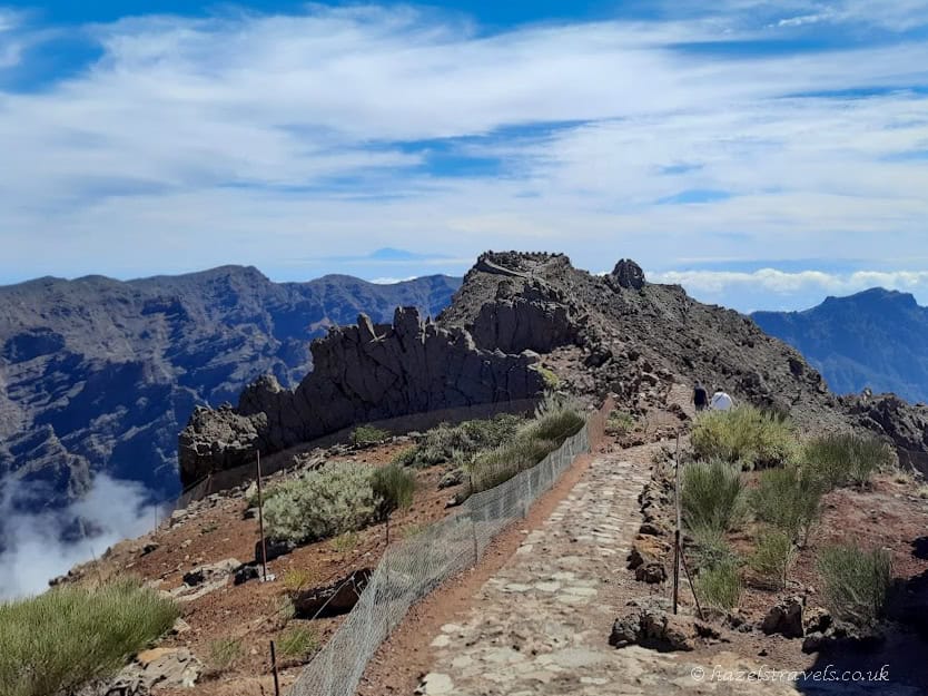
El Time Mirador: A Wider View 🗻
Later, I drove north along the famous LP-1 road to Mirador El Time – one of the best viewpoints on the island. From here, you get a wider perspective of the eruption zone.
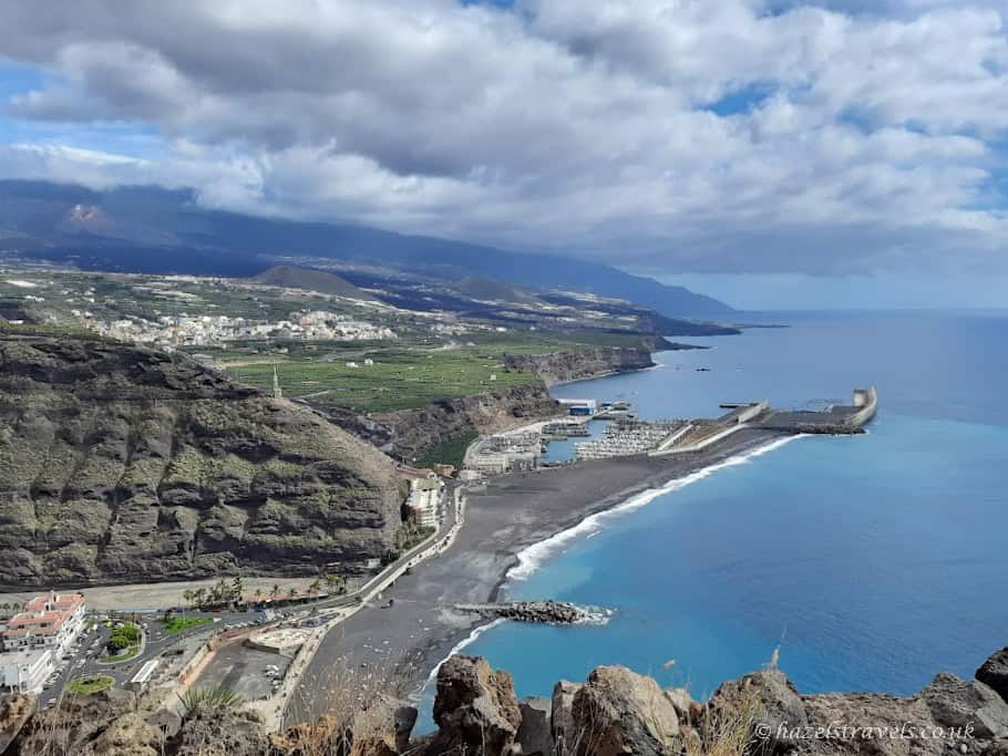
You can trace the twin lava flows in the distance, snaking through the Aridane Valley all the way to the sea. The new volcanic cone rises in the distance, stark and open (it’s in the top left of the photo).
At first, I felt overwhelmed. The scale of it all – the silence, the destruction – hits you hard.
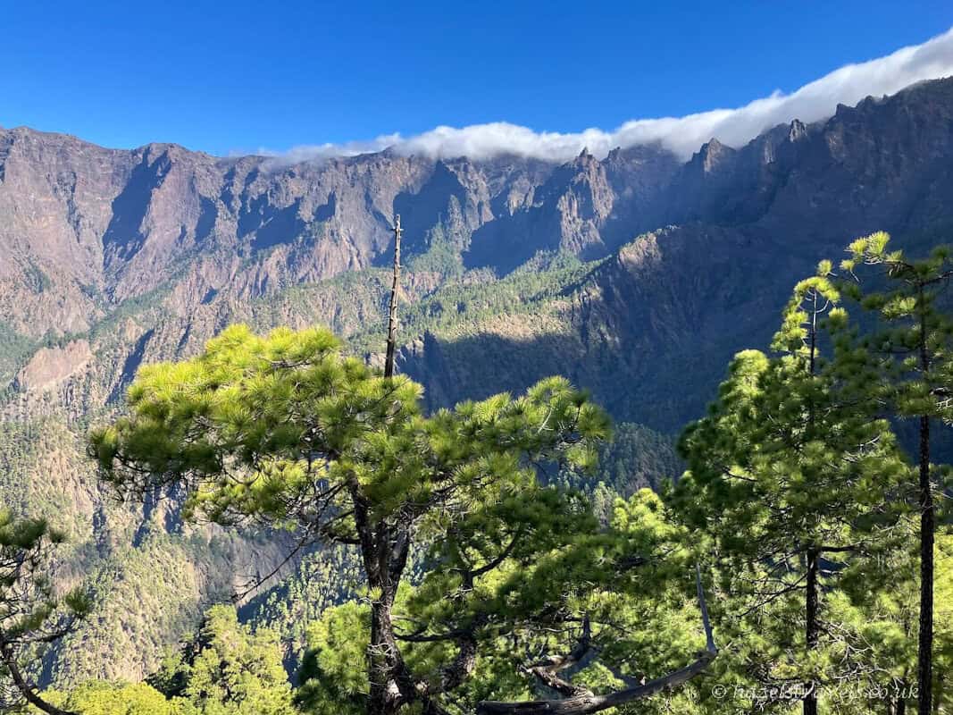
But with time, you start to notice something else: the beauty. The strange, moon-like textures of the rock. The pine trees already creeping back. The stillness that invites you to pause and reflect.
Back on the crater rim, looking down over that transformed valley, I realised it wasn’t just about what had been lost. It was also about how much strength, grace, and resilience La Palma had found in the aftermath.
People are rebuilding. Nature is returning. And the view from Volcán de San Antonio isn’t just a view of destruction – it’s a testament to survival.
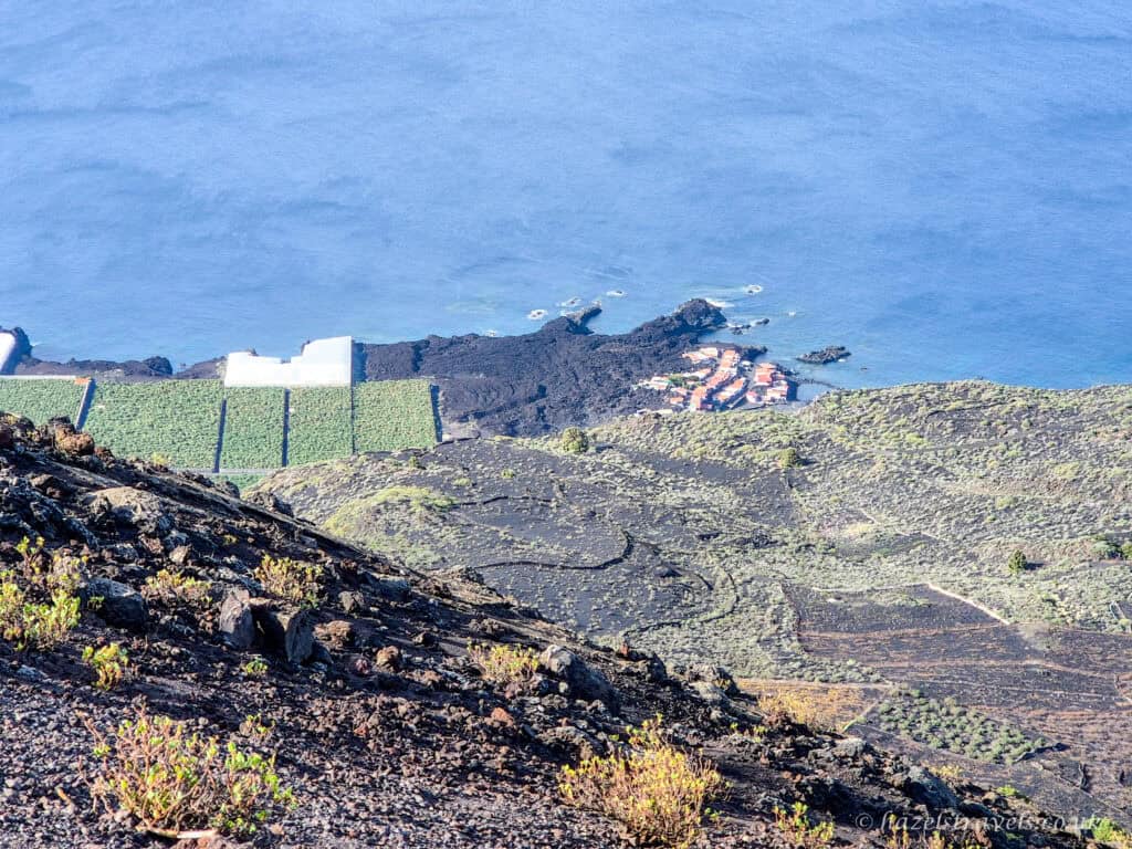
Above, you can see green banana‑plantation grids alongside dark lava – a reminder of how the island’s landscape and agriculture continue to adapt in the shadow of the eruption
La Palma is still La Palma – wild, beautiful, and welcoming. But the story of Cumbre Vieja is now written into its trails, coastlines, and everyday conversations. And if you stand quietly for a moment, you’ll feel it too.
Related Reading for La Palma 🖤
🍷 La Palma Travel Guide: Where to eat, stay and explore.
🌋 Things to Do in La Palma: Volcanoes, viewpoints, and wild nature.
🏛️ La Palma’s Prettiest Towns: From colourful seafronts to peaceful highlands.
🗓️ 5 Days in La Palma, Canaries: A compact itinerary with one base area.
🌋 7 Days in La Palma: A Week of Volcanoes & Forests.
Pin It for Later 📌
Save this post to your Canary Islands or La Palma travel board on Pinterest so you can find it later – especially if you’re planning to visit the volcano trails or want to understand more about the 2021 eruption. Perfect for nature lovers, hikers, or anyone fascinated by raw, powerful landscapes.
👉 Looking for practical travel tools? Check out my Travel Resources page.
Leave a Reply